About This Route
The opening sector of the GR13: 24.2 km from the Guadiana at Alcoutim through megalithic sites and schist hamlets to Balurcos. Officially graded IV – Hard, with 840 m of ascent on day one.
This is where the GR13 begins: at the pier in Alcoutim, on the west bank of the Guadiana, beside a statue commemorating the smugglers who once worked this stretch of river. Spain is directly opposite — Sanlúcar de Guadiana, close enough to read the signs on the buildings, connected by a small ferry. At 6 m above sea level this is the lowest point on the entire 308.5 km trail.
The sector is graded IV – Hard on the official scale, and the numbers explain why: 24.2 km with 840 m of ascent and 653 m of descent, at roughly seven hours of walking. It is the second-longest of the four "hard" or "very hard" opening sectors, and it comes on day one, before your legs have adjusted. Several people split it at Cortes Pereiras.
Waypoints
| km | Waypoint | Notes |
|---|---|---|
| 0.0 | Alcoutim Pier (N37°28'17.65" W7°28'16.53") | Official start. Information panel, ATM, tourist office |
| 0.3 | Alcoutim town | Castle (14th c.), Old Castle (8th–11th c.), Igreja Matriz |
| 0.5–3.5 | Shared with GR15 – Guadiana | Runs alongside the river on flat, low path |
| ~7 | Cortes Pereiras | Lavajo Megalithic Complex (c. 3500 BC) just west |
| ~9 | Lavajo Menhirs | Standing stones; the sector's archaeological highlight |
| ~11 | Afonso Vicente | Schist and greywacke houses, drystone-walled gardens. Malhão Dolmen nearby |
| ~14 | Forest section | Relief steepens; repeated climbs and drops |
| ~17 | Alcoutenejo Gorge | Stream feeding Ladrões Gorge and the Cadavais |
| ~19 | Corte Tabelião | Village, then descent to Ladrões Gorge |
| ~21 | Corte Seda | Crosses the EN 122-1 |
| ~23 | Torneiro | Joins PR2 ACT – Ladeiras do Pontal |
| 24.2 | Balurcos | Sector ends. Max altitude 206 m at Balurcos de Baixo |

Character of the walking
The first three kilometres are flat and easy, tracking the Guadiana through a valley of dryland orchards — carob, almond, fig and olive, much of it still worked. The route then turns inland and west, and the character changes: old paths flanked by drystone walls, hamlets of schist and greywacke, and after Afonso Vicente a forested section where the relief becomes genuinely tiring. The last third is a repeated sequence of gullies and stream crossings. None of it is technical; all of it accumulates.
Heritage on the route
Alcoutim itself is worth an extra night. The village castle (14th century) houses an archaeology museum, the Old Castle dates from the 8th–11th centuries, and the former residence of the Counts of Alcoutim is now the House of Culture. The Dr João Dias Museum and the Sacred Art Museum both require advance booking through the Town Castle.
The Lavajo megalithic complex and the Malhão Dolmen at Afonso Vicente are on the route itself and date to roughly 3500–2500 BC.
Wildlife
Part of the sector crosses the Guadiana Natura 2000 site (PTCON0036). Bonelli's eagle, Eurasian eagle owl, rufous-tailed scrub robin, golden oriole and azure-winged magpie are all recorded here. Otters are present in the watercourses but rarely seen — look for spraint on rocks instead.
Logistics
Getting there: Vamus Algarve bus line 34 runs Balurcos de Cima – Vila Real de Santo António and stops in Alcoutim, which makes this sector unusually easy to do as a day walk with a bus at each end.
Water: Available. Corner shops in Alcoutim and at Cortes Pereiras. The official listing for this sector is "Yes", but that is relative — carry three litres in warm weather.
Cash: ATM in Alcoutim. Nothing after that.
GPX: Almargem publish the official track free as Sector_1_VAlgarviana.gpx, along with a downloadable PDF sector guide.
Route data verified against the official Via Algarviana Sector 1 page published by Associação Almargem, August 2026.
Prefer a Guided Tour?
Go with a local guide who knows the best spots along this route
Bike Ride to Castle of Aljezur Portugal Tour
From €90
Twister Private Water Tubing in the Algarve
From €15
Twister Ride, Algarve, Portugal
From €15
Elevation Profile
Trail Details
Safety Notes
Officially graded IV – Hard: 24.2 km with 840 m of ascent, and it is day one of the trail. Remote, with limited mobile coverage between villages. Carry at least 3 litres of water in warm months. Corner shops exist at Alcoutim and Cortes Pereiras but keep irregular hours. ATM in Alcoutim only. Emergency: 112. Fire: 117.
Best Time to Visit
Best February–May and September–November. Avoid June–August: the eastern interior regularly exceeds 40 °C and this sector has long stretches without shade. Winter is walkable and often beautiful, but daylight is short for a seven-hour sector — start early.
What's Nearby
Discover more within 10km
Alcoutim
Remote inland village on the Guadiana River facing Spanish village of Sanlúcar de Guadiana. Medieval castle, river beaches, almost total tranquility. Zip wire across the river.

More Routes to Explore
Discover more of the Algarve
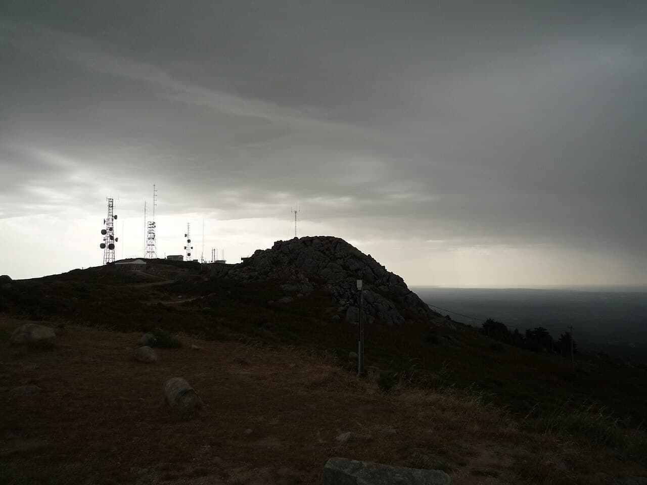
Fóia Trail
The official PR3 MCQ circular on the Algarve's highest mountain: 6.8 km starting at the Fóia summit car park, descending to the EN 266 and climbing back. Rated somewhat difficult, with rare Monchique rhododendron in spring.